图书介绍
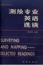
测绘专业英语选读PDF|Epub|txt|kindle电子书版本网盘下载

- 陆铁镛主编 著
- 出版社: 北京:测绘出版社
- ISBN:7503004509
- 出版时间:1991
- 标注页数:610页
- 文件大小:17MB
- 文件页数:621页
- 主题词:
PDF下载
下载说明
测绘专业英语选读PDF格式电子书版下载
下载的文件为RAR压缩包。需要使用解压软件进行解压得到PDF格式图书。建议使用BT下载工具Free Download Manager进行下载,简称FDM(免费,没有广告,支持多平台)。本站资源全部打包为BT种子。所以需要使用专业的BT下载软件进行下载。如BitComet qBittorrent uTorrent等BT下载工具。迅雷目前由于本站不是热门资源。不推荐使用!后期资源热门了。安装了迅雷也可以迅雷进行下载!
(文件页数 要大于 标注页数,上中下等多册电子书除外)
注意:本站所有压缩包均有解压码: 点击下载压缩包解压工具
图书目录
Lesson One Surveying1
Lesson Two Geodetic Surveying and Plane Surveying8
Lesson Three Types of Surveys15
Lesson Four Map Projection and Maps21
Lesson Five Accuracy and Precision,Errors and Mistakes28
Lesson Six Systematic Errors35
Lesson Seven Field Notes and Notebook44
Lesson Eight Recording Data52
Lesson Nine Computations and Checking59
Lesson Ten Computational Aids65
Lesson Eleven Electronic Distance Measurements72
Lesson Twelve Basic EDM Theory78
Lesson Thirteen Errors in Electronic Distance Measurement85
Lesson Fourteen Leveling and Levels(1)92
Lesson Fifteen Leveling and Levels(2)100
Lesson Sixteen Ordinary Leveling(1)107
Lesson Seventeen Ordinary Leveling(2)115
Lesson Eighteen Profile Leveling122
Lesson Nineteen Common Leveling Mistakes and Errors(1)130
Lesson Twenty Common Leveling Mistakes and Errors(2)136
Lesson Twenty-one Care of Equipment142
Lesson Twenty-two Transits and Theodolites148
Lesson Twenty-three Traversing153
Lesson Twenty-four Control Surveys163
Lesson Twenty-five Triangulation(1)169
Lesson Twenty-six Triangulation(2)176
Lesson Twenty-seven Trilateration183
Lesson Twenty-eight Topographic Surveying188
Lesson Twenty-nine Contours194
Lesson Thirty Photogrammetry203
Lesson Thirty-one Aerial Photographs209
Lesson Thirty-two Photogrammetric Control Surveys218
Lesson Thirty-three Mosasics and Orthophotos228
Lesson Thirty-four Photogrammetric Stereoplotters231
Lesson Thirty-five Orientation and Map Compilation239
Lesson Thirty-six Close Range Photogrammetry and its Origins245
Lesson Thirty-seven Instrumentation for Close Range Photogrammetry252
Lesson Thirty-eight Remote Sensing(1)259
Lesson Thirty-nine Remote Sensing(2)268
Lesson Forty Remote Sensing(3)274
Lesson Forty-one Construction Surveying282
Lesson Forty-two Preliminary Surveys and staking287
Lesson Forty-three Building Layout297
Lesson Forty-four Bridge Surveys and Pipe Laying305
Lesson Forty-five Route Surveys313
Lesson Forty-six Grade and Alignment by Laser-equipped Instruments321
Lesson Forty-seven Dams327
Lesson Forty-eight Gyro-theodolite(1)332
Lesson Forty-nine Gyro-theodolite(2)340
Lesson Fifty Applications of Geodesy349
Lesson Fifty-one The Celestial Sphere356
Lesson Fifty-two Azimuth and Latitude Determination364
Lesson Fifty-three Satellite Geodesy372
Lesson Fifty-four Inertial Survey System377
Lesson Fifty-five Global Geodesy384
Lesson Fifty-six Adjustment Computation by Least Squares(1)390
Lesson Fifty-seven Adjustment Computation by Least Squares(2)395
Lesson Fifty-eight The Spheroidal Earth402
Lesson Fifty-nine The Art and Science of Cartography410
Lesson Sixty The Scope and Nature of Cartography417
Lesson Sixty-one Topographical Map Projection(1)428
Lesson Sixty-two Topographical Map Projection(2)438
Lesson Sixty-three Map Grid445
Lesson Sixty-four Relief(1)453
Lesson Sixty-five Relief(2)461
Lesson Sixty-six In the Cartographic Drawing Office(1)468
Lesson Sixty-seven In the Cartographic Drawing Office(2)477
Lesson Sixty-eight In the Cartographic Drawing Office(3)486
Lesson Sixty-nine Something about Map Reproduction494
Lesson Seventy Computers and Cartography508
Appendix Ⅰ Vocabulary518
Appendix Ⅱ Key to the Exercises603